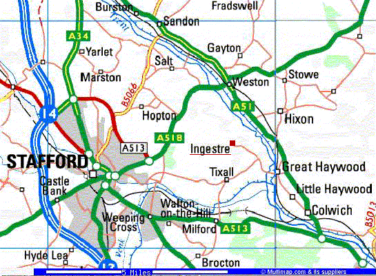
Ingestre is a small village about 3 miles east
of Stafford, the county town of Staffordshire in England. The village
lies on the western side of the valley of the River Trent. The Church
has the OS Map Reference SJ 977 247.
This year, 2001, there are 98 resident electors and
41 dwellings. Three Councillors represent Ingestre on the Parish Council of Ingestre with Tixall. Local Information gives bus, mobile library
times, etc.
The history of
Ingestre dates from before Domesday, with evidence of prehistoric
activity in the Trent Valley. Soon after Domesday, the manor passed to
the De Mutton family, and thence by marriage to the Chetwynds, who
subsequently became Earl
Talbot and then Lord Shrewsbury. A Local
History Group meets monthly.
Until the 1960s Ingestre was an Estate of
over 1100 acres owned by Lord Shrewsbury, who lived at Ingestre Hall. In 1960 the estate was divided
up and sold, with Sandwell Metropolitan Council purchasing Ingestre
Hall.
Ingestre is a Conservation Area and contains several Listed
Buildings, although only Ingestre Church,
attributed
to Wren, is open to the public by prior arrangement:
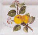 Ingestre is also
associated with a strain of Golden Retriever Dogs, bred by the head
Gamekeeper, Donald MacDonald in the early 1900s, and with a type of
apple, the Ingestre Pippin. A 3 ft Crocodile found alive in a
drain at Great Haywood around 1827, was said to have been stuffed and given to Lord Talbot at
Ingestre Hall.
Ingestre is also
associated with a strain of Golden Retriever Dogs, bred by the head
Gamekeeper, Donald MacDonald in the early 1900s, and with a type of
apple, the Ingestre Pippin. A 3 ft Crocodile found alive in a
drain at Great Haywood around 1827, was said to have been stuffed and given to Lord Talbot at
Ingestre Hall.